Map created using QGIS 3.10 on Windows 10 using a 1:120000000 scale and the World Robinson projection (EPSG 54030)
Map details
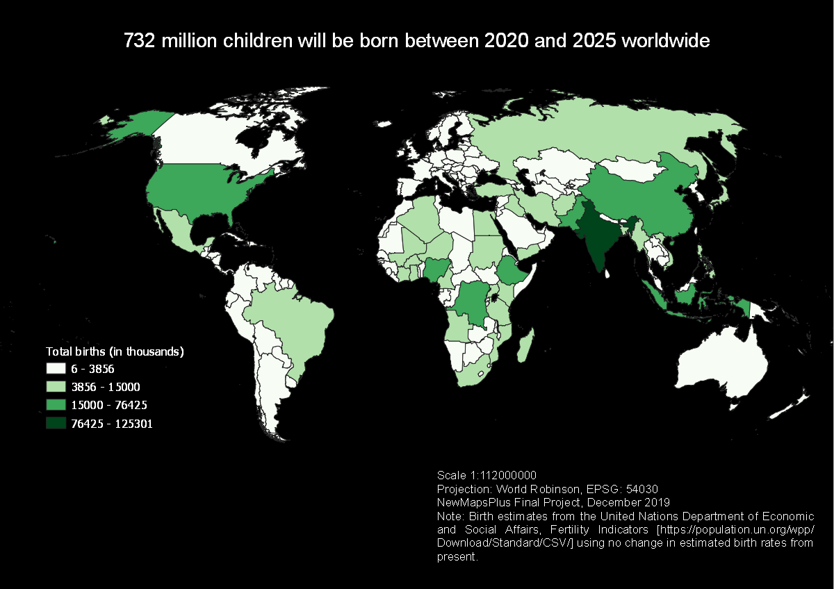
Total births
The United Nations maintains projections of global birth rates by countries and by region. This resource is available from this downloads page. The specific dataset of interest is Fertility Indicators.
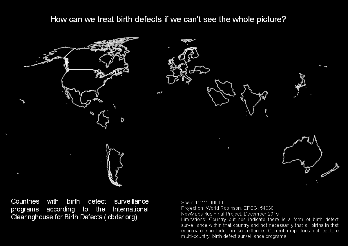
Birth defects surveillance
The International Clearinghouse for Birth Defects Surveillance and Researchis one place where multiple entities combine data about birth defects. There are other places where this information is combined, for example EUROCAT.
For this map, the ICBDSR provides a list of places where surveillance programs occur. This list can be copied and pasted into a text document or excel file.
Country maps
A shapefile that contains countries of the world is available from Natural Earth, specifically the Admin 0 – Countries option without boundary lakes. A direct download of this file is available here.
Methods
For more information about the methods used to create these maps, please see the methods described on GitHub.
University of Kentucky New Maps Plus, December 2019